
Three holy mountains, breathtaking landscapes, a solo adventure hike through unparalleled beauty, capricious weather, and high passes. Yading Nature Reserve is a real wonder of China! Here’s all you need to know about it, may you be a trekker or a regular visitor.
For my first solo trek I chose, or to be precise I stumbled upon, something special. Yading Natural Reserve is indescribable when it comes to the scenery: high meadows and yak’s pastures, a multitude of high mountain lakes, rocky peaks, snow-capped summits and glaciers, huge valleys and high plateaus, lots of streams and waterfalls, and amazing colours.
For good reasons it is considered by many online guides one of the must-do hikes in a lifetime, and probably the most beautiful trek in China. It’s Tibet without the need for any permits!
I must admit I didn’t even know about it. I just happened to talk with two guys in a hostel in Shangri-La City who had just done the trek. The magic of travelling! 🙂
So, they tell me about this natural park in the Ganzi Tibetan Autonomous Prefecture, in the Sichuan province, which revolves around three holy mountains.
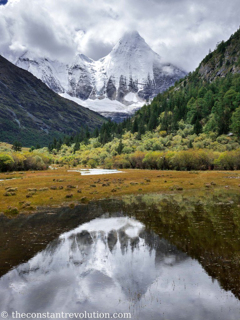
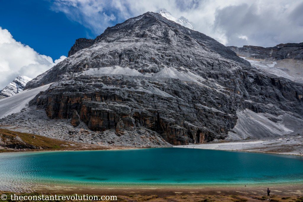
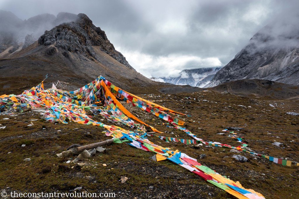
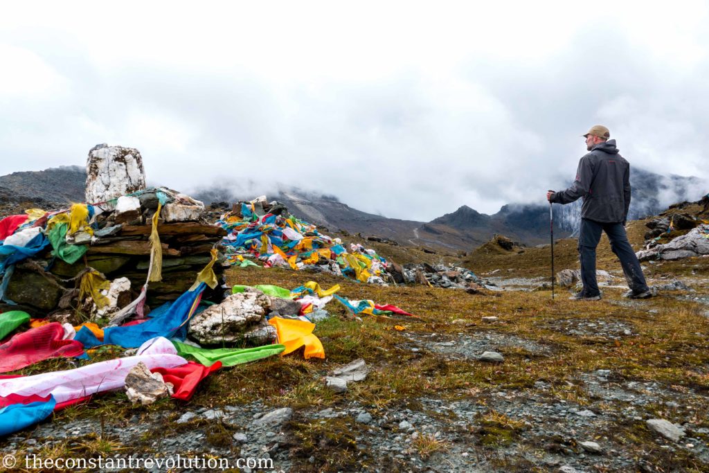
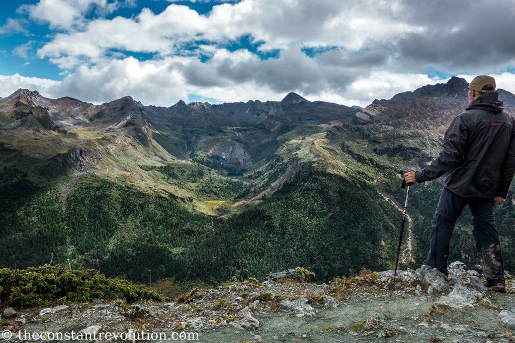
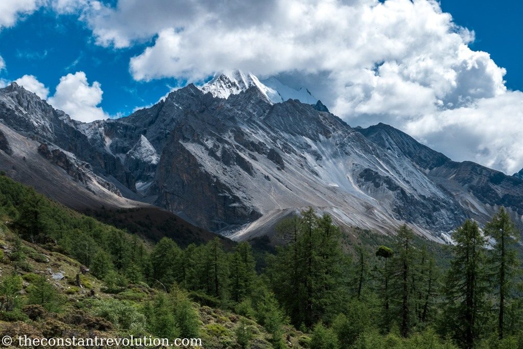
Local Tibetans revere them as emanations of the three bodhisattvas of compassion, wisdom, and power. Going on a pilgrimage around their peaks, they believe, helps accumulate merit and purify negative karma. They are the Xiannairi (6032 m – featured photo), the Yangmaiyong (5958 m) and the Xianuoduoji (5958 m). Prayer Flags can indeed be seen all over the trek, especially at the passes.
The Yading Big Kora trek (Kora means “holy pilgrimage”) takes three days, it circles around the three holy mountains for a length of about 60 Km, and it is entirely above 4000 m. It’s also possible to do a small Kora, which goes around the highest peak and last for two days and 30 Km.
The temptation was too strong! I was waiting for an occasion to go on a solo trek, sleep in my tent, test my resolve, my strength, confront my fears. What could be a better occasion than a holy pilgrimage trek? This looked just marvellous. It was on the route I had in mind for my travel in China no less, perfect. I started to do my research, and to get ready for the adventure.
Here’s the report of it, with many photos as usual, but most importantly with everything you need to know to visit Yading Nature Reserve, as a trekker or not.
THE TOURIST WAY
Indeed, there’s no need to be a masochistic, weight carrying, loner trekker to go and admire the Reserve. There is a more “touristic way”, which allows cutting across the park, instead of going around it and go visit the iconic Five Colour Lake (4700 m) and Milk Lake (4600 m). All of this is possible in one day, and with very little effort.
Basically, Yading town marks the entrance to the Reserve. From here you can buy your ticket. A huge fleet of buses take hordes of Chinese tourists up and down the beginning of the tracks, at about 3900 m altitude. It’s a beautifully scenic drive with mountains all around at the hearth of the Reserve, and lasts for about 40 minutes. It’s also quite compulsory, unless you want to walk all the way up along a twisty and trafficked tarmac road.
Once up, you can decide to walk along an easy wooden or iron made path for a few Km, OR you can decide to take a mini electrical bus that will take you further up. At the end of this ride, you can decide to walk along a regular mountain path, OR use some mules to take you further up. Only at the end of the mules track you are obliged to walk, for the last 200 m or so in elevation, and reach the two lakes. At the top there’s a small loop to follow to see both of them.
So, that’s that. Anyone can visit Yading Natural Reserve. I mean it. And it is totally worth doing so, even without trekking, or camping, or anything of the kind. The place is just too beautiful.
MY WAY: TOURIST TRACK AND BIG KORA
It so happens that on my first day I followed the crowd and the tourist track, and ended up having to change my plans and make up my own trek.
I didn’t do it on purpose, I just made a mistake in understanding where the Big Kora started. So, I have walked all the way up to the lakes.
It’s been fun to walk with my big backpack and all the equipment among so many Chinese with sneakers, fashionable clothes, and an oxygen bottle they purchased just before getting on the first bus ride. Most of them would not understand what I was doing, they would just give me a thumb up (for the weight) and sometimes ask to take a photo with me.
In the end, I am glad it went this way as it allowed me to see the Reserve from a different perspective, and go visit the two iconic lakes which wouldn’t otherwise be on the Big Kora track (although there are many nameless others).
Here is the description of the adventure day by day, if you are interested in practical information about visiting the park scroll down after day 4.
DAY 1 – TOURISTIC WAY AND BEYOND – 7h – 15 to 20 Km
I wake up early and take a minivan from Daocheng to Yading, where I arrive around 10h. Here I get my ticket, take the scenic bus ride that takes me up, and reach the beginning of the tracks around 11h.
I don’t know where the Big Kora starts. I try to ask but no one speaks English, and they keep pointing me towards the direction of the visible track. By mistake, I take the touristic way and I end up with the rest of the crowd cutting across the Reserve for the whole day. Yet, it is touristic for a reason, it is beautiful.

It’s half halfheartedly sunny, I play along with Chinese tourists, take photos and selfies and get to see the iconic Five Colours and Milk Lakes, and two of the holy mountains summits. I would have not seen them again until the last day of the trek!
My first thought is to go back to the entrance with the crowd, sleep one night in the village inside the Reserve, and the day after starting the real Big Kora. However, at the Milk Lake I check my GPS viewer and realised that by cutting across I have almost reached one of the passes on my track.
So I decide to continue. From the moment I leave Milk Lake behind, I am completely on my own. I reach the pass, at about 4680 m, I check again and I am on the Big Kora track. Yay, I pat my own shoulder for the intuition. Behind me, in the far distance, the hordes are starting to withdraw. They will sleep in some comfortable bed in a Tibetan style guest house tonight. I look at them and mentally say goodbye.


It starts to get cloudy, with a little bit of rain, but I have to walk clockwise for another two hours before reaching the lowest possible point, at 4300 m. where I camp for the first night, in the middle of some bushes. During these two hours walk, the snow-capped summits of two of the holy mountains are clearly visible on my right side, including the tallest and steepest one, the Xiannairi (6032 m). The shape of this mountain gives vertigo, it’s like an arrow pointing to the sky. It reminds me a little bit of Monte Cervino, in Italy.
It’s almost 18h30 when I am done pitching my tent. I am tired. Dark comes at around 19h. A thick fog surrounds me, visibility is no more than 10 metres all around. The calmness is absolute. The drops of rain against the top of the tent and a stream nearby are the only noises I can hear. I eat, I lie down, and I fast fall asleep.

Conversations with the shepherds
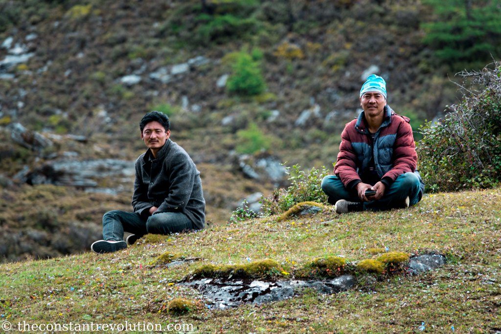
A short digression. I spent three days on Yading Big Kora trek alone, crossing path only with the occasional shepherds, maybe once per day. They would be in pair most of the time (mountain wisdom), doing I have no idea what.
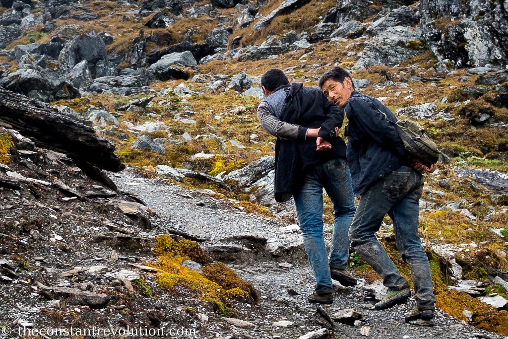
With each of them I would have the same conversation, every time, and it would go like this:
first, they would call me out and smile at me. I would smile back and say hi with a gesture. Then one of them would draw a circle in the air with the index, asking if I am going for the big tour around the holy mountains. I’d nod. Then he would circle the finger in the other sense as to say “normally people go clockwise” to which I’d respond, with my Italian gesturing “yes I know, but I fucked up the first day and I am doing it the other way around, capisce?” and smile some more. Once accepted this weird fact, the same guy would show me the index, as to ask “are you alone?” At my affirmative answer he would then give me a thumb up! It’s always good to be appreciated. 🙂
I loved this little ritual, it gave me warmth. In a way, we understood more each other with these guys than with all the Chinese tourists on the other side, to whom I could not speak anyways.
One of the shepherds also kindly pointed up at some rocky walls high above us, to show there was a big herd of mountains goat. For the love of me I couldn’t figure out the specie. Not even on the internet. They started to make noise to make them climb up. I asked if there are predators around, always with gestures, and they told me there are none. Good for the goats, although I saw a little cunning spark in the shepherd’s eye there.
End of digression, be happy!
DAY 2 – THE THREE PASSES – 8 h – 18 Km
The night is rainy, and the morning cloudy. I wrap up my moist tent and start walking around 8h into the white of the cloud. Light came at around 7h. The direction is that of the first pass (4688 m), which I have already encountered yesterday, the one from the Milk Lake. So, I am going anticlockwise. If I’d continue in the same direction, it would mean to end the trek today, after 10 Km. That is not what I want.
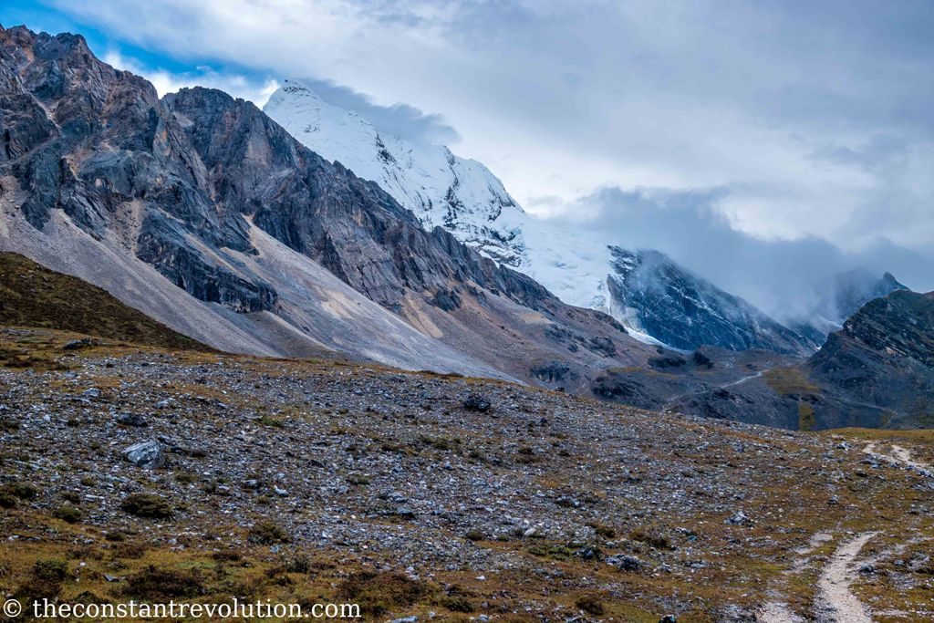
The summits I could so clearly see the previous afternoon are hidden, so is everything else. The narrow, rocky paths are wet, and the ups and downs really steep. My legs and shoulder feel the weight of the altitude, and my breath is constantly short. Often the cliff on the side of the path is vertical, I have to pay attention to where I put my feet. I reach the first pass and continue on the right side of the mountain this time, no detour towards the inside where the Milk Lake is.
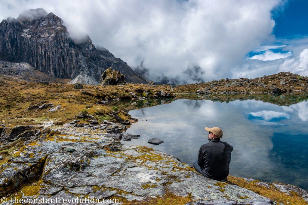
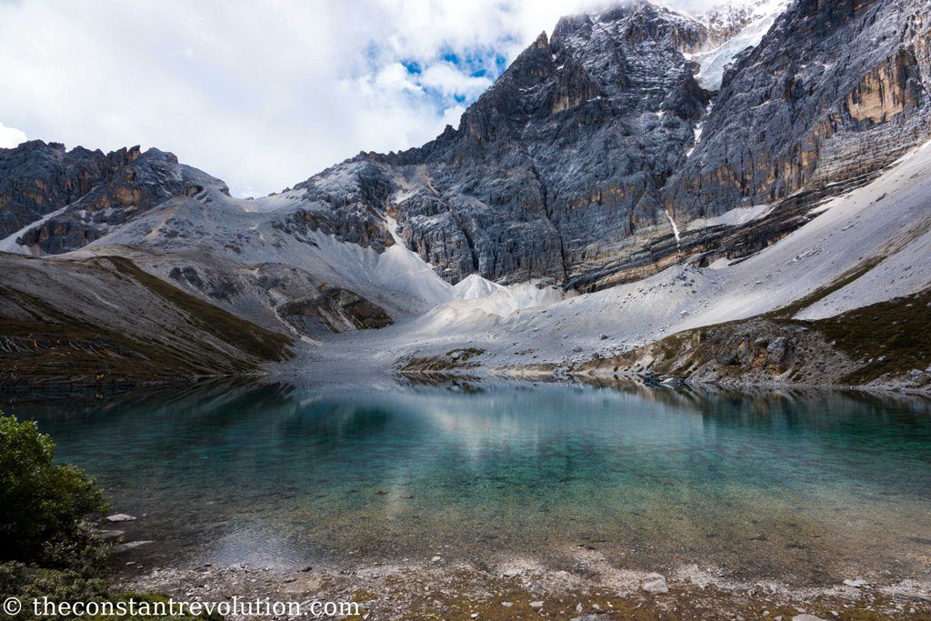
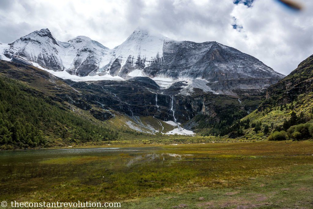
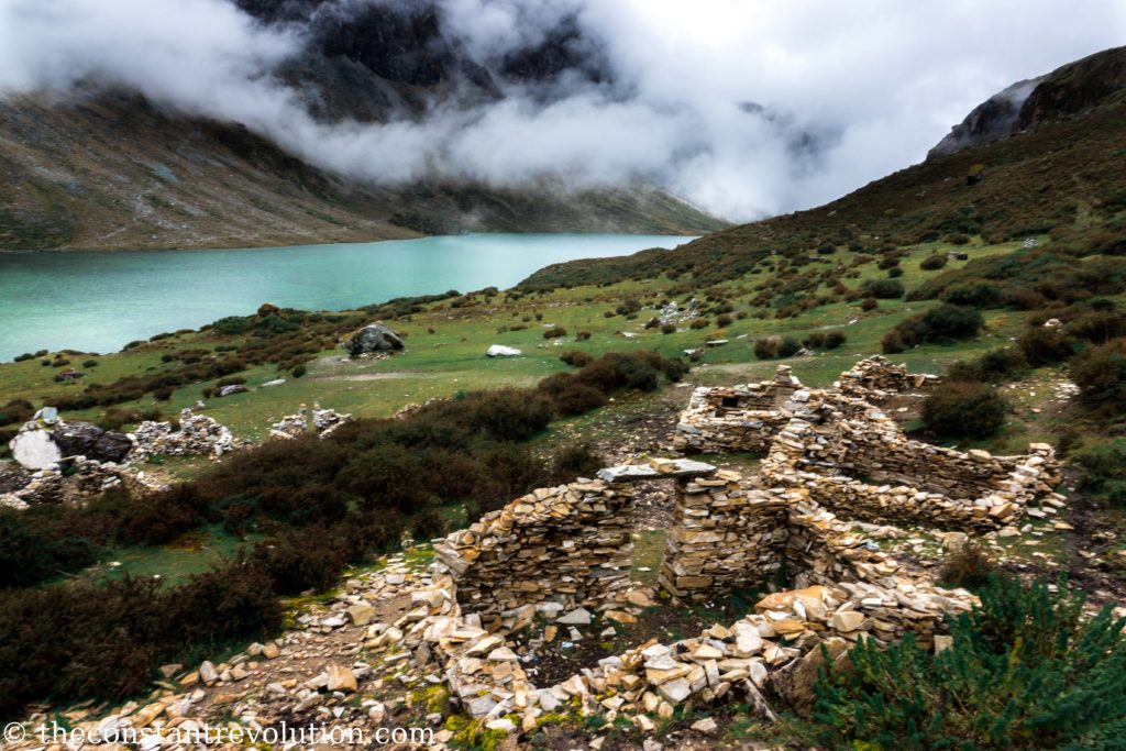
After a couple of hours the sun starts to become warmer, and the clouds open up and show a little piece of the show. Many nameless altitude lakes, with crystal clear green or blue waters start appearing. High up is always covered, but the landscapes are beautiful nonetheless. I go down to about 4450 m, then up again for the second pass (4720 m), and then down into a wide valley with a small lake.
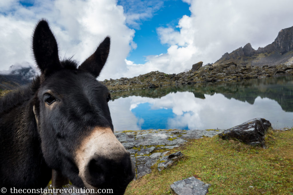
Here I have lunch and some rest, alone in the whole valley, in front of the lake, the only company some mules grazing around. They become friendlier over time, curious as all equines are, and decide to come and get some patting on the nose, and play the model for my photography, just before I take off again.
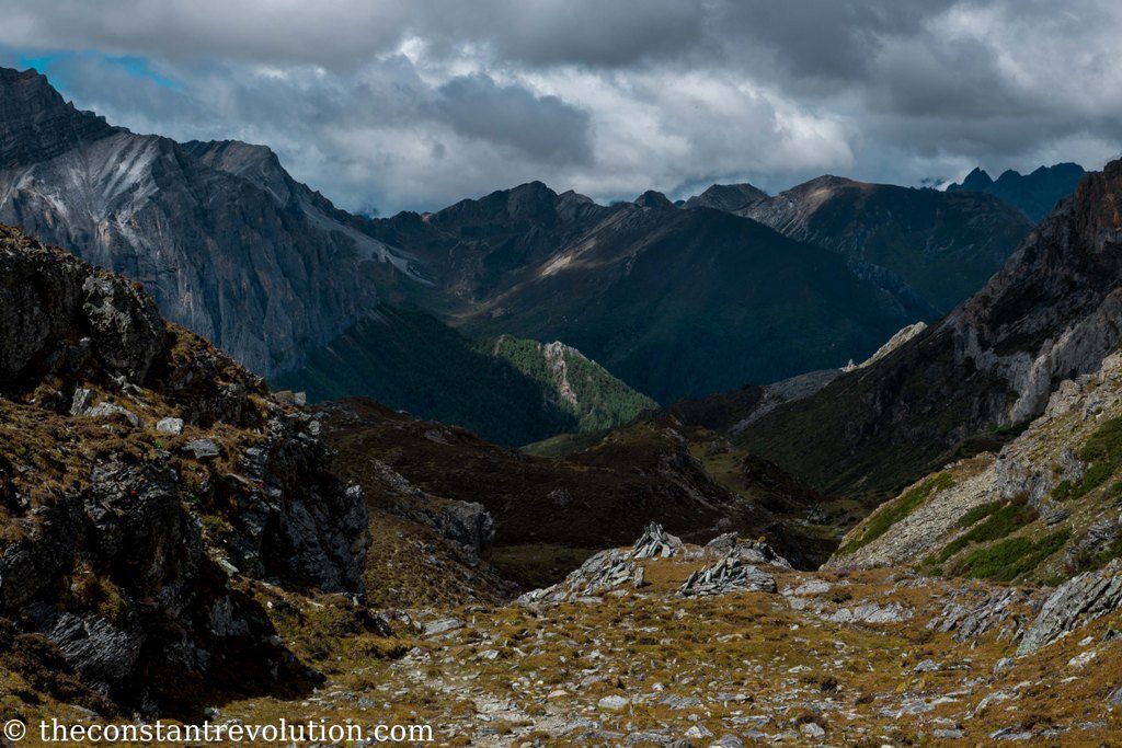
A small hour later it’s cloudy again, the weather is getting worse. I am in the white of the cloud, and I continue to walk with few metres visibility. When I reach the third pass (4715 m) there is no visibility, the same goes for the highest point of the day, at 4790 m, and during the descent to the point called amphitheatre (4290 m).
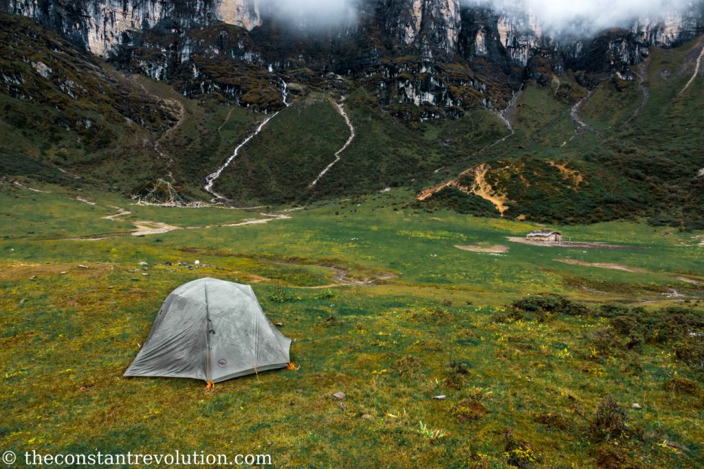
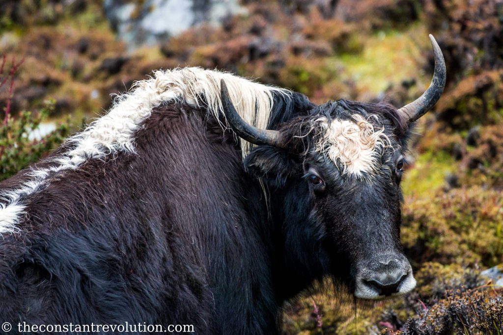
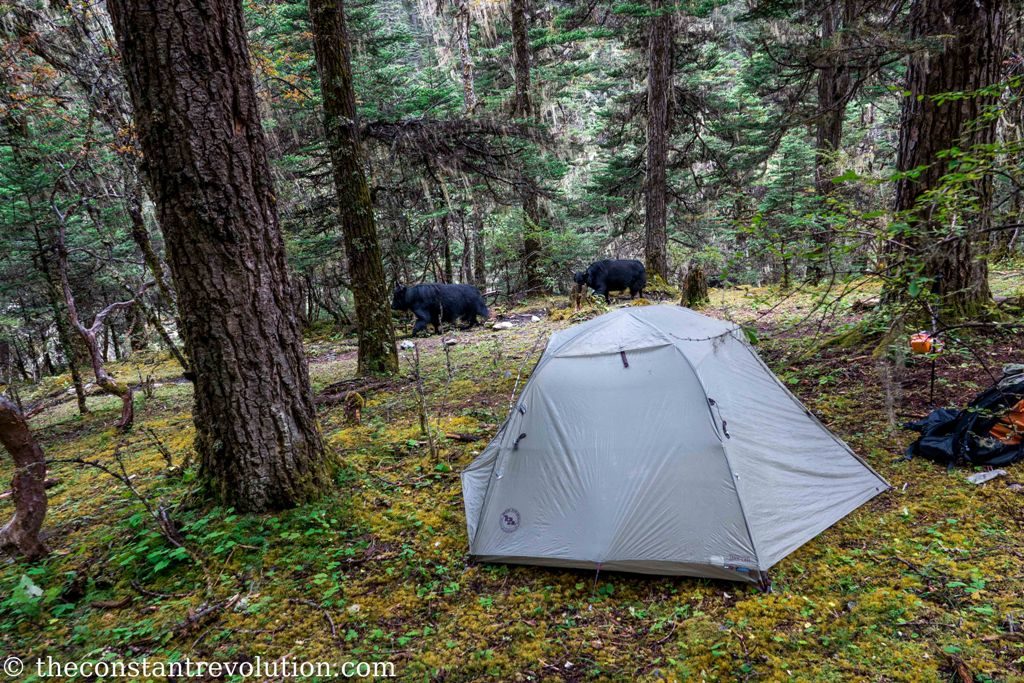
This is a huge meadow, with a nice view of a valley and faraway mountains on one side, and protected by high walls on the other. Yaks all around, a stream cutting across, and a small hut in the middle, probably used by shepherds.
It’s clearly used as a campsite by many people. I can tell by the rubbish left behind. I struggle to find a spot where to pitch my tent, then I decide for a corner a little exposed, but I hope to wake up with a nice view in the morning. Hope never dies (Italian proverb).
DAY 3 – TWO MORE PASSES – 8h – 15 Km
Not even close! It’s been the rainiest of nights. When I wake up, it’s still raining, softly, and all around me is just a big white. So much for the nice view. I wrap up my stuff hastily, eat my spicy noodles for breakfast, and start walking again around 8h.
For the whole morning there’s very little visibility. It’s a long way to the first pass today, I am low in elevation. I pass through a nice pine forest, very mystical with all that fog. Some waterfalls, streams, a lot of water, a lot of mud. Then, a little higher up, I pass through a big rocky valley, with yellow grass. I have to jump from a rock to the other as there is no real track.

At the pass (4728 m), despite small openings here and there, I am still in the cloud.
I go down to about 4400 m again, and I have lunch in a valley with big rocks all around. The next target is far, not in altitude, but in length. I still have to walk for many Km, mud and water make my steps carefully slow.
The good news is the clouds are opening up. Even though I can’t see the summit of the holy mountains, now I am walking with an open view, and it’s a pleasure for the eyes and a blessing the spirit.
At the second pass of the day (4540 m) I have a clear view on both sides, and a big smile on my face.
When the clouds give permission to see the beauty of these mountains, even if a glance at the time, you understand why you are working so hard with your mind and body to be there. You understand the privilege to be there on your own, the only human being looking at that stunning view at that moment, for that day. It’s only for you, it’s a gift for your work, for your pain, for your will.

I enjoy the moment, I take my time. Then I leave those mountains behind, where they will remain for a long time, and I start my long descents to a 4000 m elevation.

I see a camping spot but I don’t like it, I walk a little more until I reach a pine forest. Very humid, like everywhere, but protected. I will be lower in elevation and a little warmer tonight. I pitch my tent there. The forest is enchanting. I feel as though hidden people would suddenly appear, and I could have a conversation with them. I assume they speak a universal language.
DAY 4 – THE HIGHEST PASS: A GAME OF CLOUDS AND TIME – 8h – 15 Km
As usual when I wake up the clouds are right there with me. I feel almost protected now by this morning presence. It’s like when you used to wake up wrapped up in the blankets of your bed, the sound of kitchen tools in the room nearby where breakfast is being prepared. Or so my mind wanders.
I start earlier today, right at sunrise. I realise there are many yaks hidden in between the trees, many baby ones. They also realise I am there, and we both look at each other surprised and amused.
It did not rain overnight, it was quiet. My tent is only humid, but not wet. I think this is a good sign. It’s only one pass to tackle today, the last one, but the highest from the lowest point. I will have to climb 900 m to reach it, from the 4000 m above sea level where I am now.
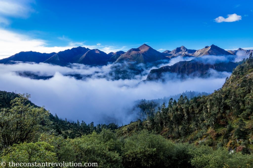
The first two hours are in the usual mist, but then, about halfway through my last fatigue on this trek, the magic happens. Clouds start to move lower, down in the valley, and I can admire a magnificent view right behind me.
But these clouds are cunning, they want to play a game with me, a game of time. The more I climb, the more they approach me. They are constantly at my shoulders, I feel chased, I feel like Atreyu chased by “The Nothing” in The NeverEnding Story. Only I don’t have a fast horse to ride, or creepy dog to fly with.
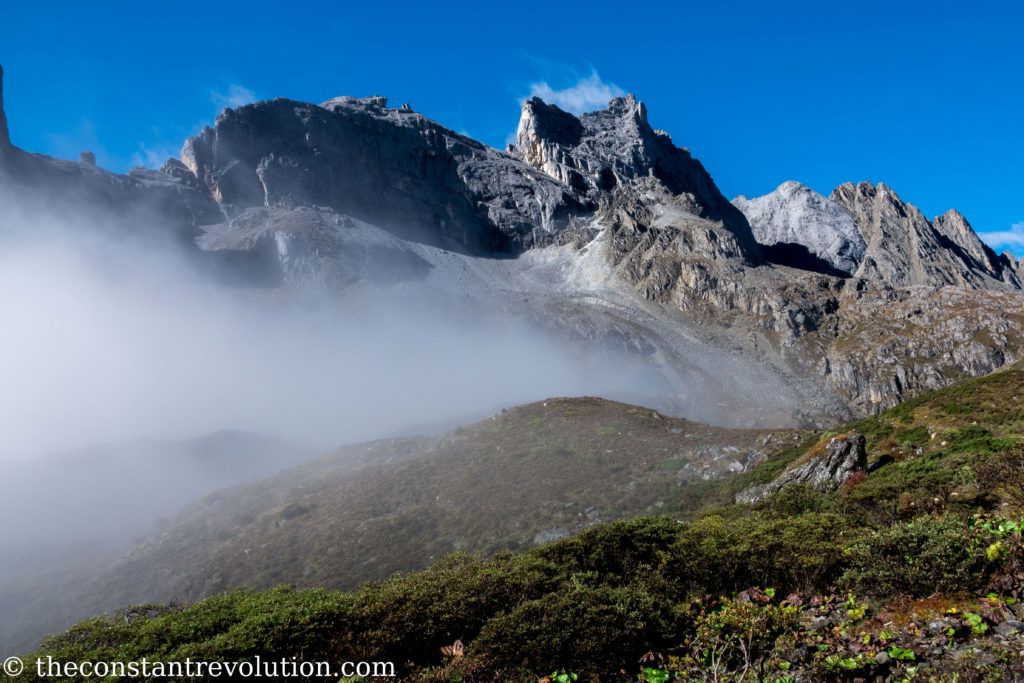
In the end it was only a game though. They were just pushing me a little bit. They knew I was no match for them. So, like a gentle protector, in the last metres of the run they withdrew, they let me win.
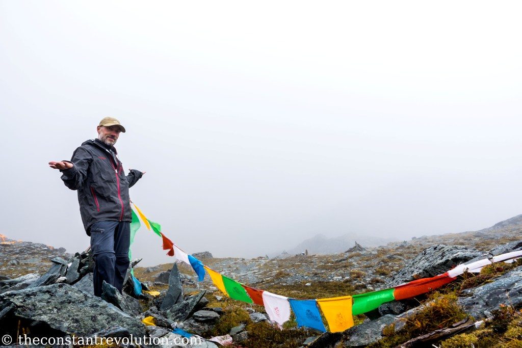
When I see the prayer flags of the last pass I am filled with happiness, and pride. Are my eyes moist? My first solo trekking, the hardest part is done. The view is magnificent. I take some time to admire it, to think about where I am, to think who I am, before I continue on my path.

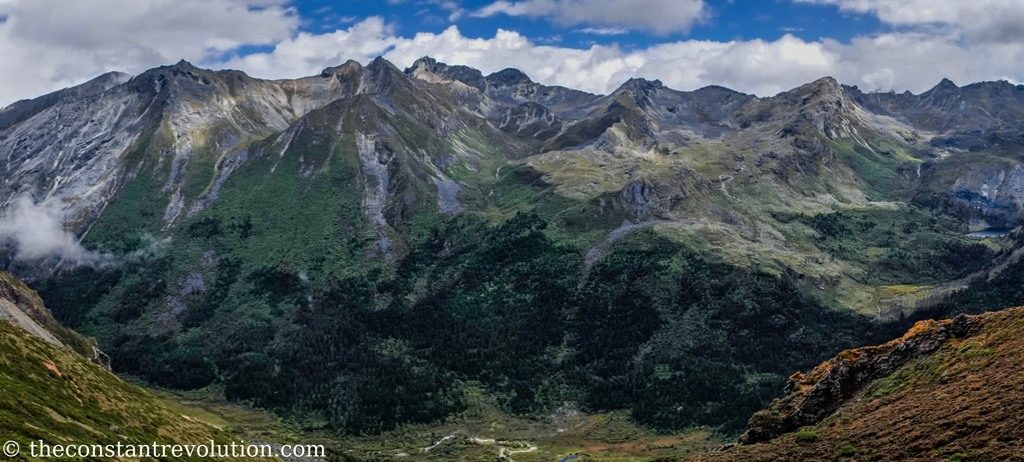
The surprises are not over. During my descent I walk along a big green valley and on the mountainside path for about two hours. The three holy mountains are right there, on my left side. I am on the Eastside now, the opposite of the first day. The sky is blue, but the summits are hiding.
It’s as though they were waiting for me to look at them. The clouds move away from the summit one at the time, slowly, as to keep my gaze focused on each of them instead than the overall picture. The first to show its majestic beauty is the queen Xiannairi (6032 m – featured image), the highest and steepest, which stands in the middle.
Only for few minutes, then the clouds return to cover it while they leave naked the summit I have not seen yet, Xianuoduoji (5958 m). It stands on the right side, and reveal itself only halfheartedly, hidden behind an impressive wall.

Finally, its sister, the Yangmaiyong (5958 m), which I had seen so well on the first day from the Westside, lured me in, kept me waiting for a while, but decided to remain shy and to keep its summit hidden for that day.
Perfection does not exist in this world, the three holy mountains reminded me of it today.
No matter, I am more than satisfied. This trek has been a great adventure, and it has gifted me with more than I would expect. I came back stronger, I regain some confidence. I am grateful.
I keep walking, quickly now, without thinking of the mountains anymore. I have 900 m to descend. I go through a lush green forest, streams and pines. It feels like home. I reach a tarmac road after an hour and a half, and I know this adventure is over, and it is time for something new.
THE REGULAR PATH
I did the trek in a weird way, and I am glad, because it worked out really well for me. The normal way would be to start from the highest pass, then walk clockwise for three days. One more day can be added if you want to take a detour to the Lake of Five Colours and Milk Lake from what has been my first pass, but normally would be the sixth.
PRACTICAL INFORMATION TO VISIT YADING NATURE RESERVE
Where to stay?
Here’s a good one. I have organised everything from a town called Daocheng, two hours drive away from Yading. This is for several reasons. First, I needed to get organised, buy food etc, so I needed a bigger town. Second, sleeping and buying food in Yading or inside the Natural Reserve would be more expensive. Third, I had to sleep a couple of nights somewhere around 3800 m to get acclimatised. Daocheng served the three purposes.
However, it’s very possible to sleep inside Yading Nature Reserve. There are small villages with Tibetan style guesthouses all along the scenic bus drive. I would guess it’s nice to wake up with that scenery in front of your eyes, or just stay there and take it easy for a couple of days. Also because there are other possibilities in terms of shorter and easier excursions inside the park, which could be taken on a daily basis.
How to get there?
You can get to Yading by bus from pretty much any previous destination. It might take time in the mountains, but it’s really easy to move around in China. I believe the closest is Daocheng though, which is a 2 hours drive away.
If you are in a hurry, you can fly to Daocheng, there’s a small airport and the closest big city for connections is probably Cheng Du, in the Sichuan province.
Equipment, food, and facilities
In short, you need to carry everything with you for the entire duration of the trek, including all camping equipment. You can read my post about travel gear and trekking equipment here. Remember, you are constantly above 4000 m, it is bound to be cold-ish. There are a couple of mountain equipment shops in Daocheng, although if you ask around no one knows they exist. No renting though, only buying.
You need to carry all the food as well. There are no shops, shelters, farms or any way of procuring food during the trek. The ideal would be to have a gas tank and a small stove to warm up water, and carry dried food only, it’s lighter and you can make tea or coffee. I didn’t have it with me and didn’t want to buy one. Here’s where China came in help.
You can buy in any supermarket some self-heating packages with noodles or rice, mostly with meat with few vegetarian options. They are bulky, but they are not too heavy (about 280 gr each). So I carried 6 of these to have warm meals morning and night, and for the rest just snacks like nuts, energy bars, chocolate etc. No tea or coffee, too bad.
No need to worry about the water, there’s a lot of it, everywhere, even too much in fact, you will find yourself often walking on very muddy paths or rock hopping among streams. So, just carry a filtering system or chlorine tablets.
As for camping, there aren’t real camping sites. You can tell by the “signs” that some spots are preferred than others, for their position at lower elevations or in between distances. However, there are no facilities whatsoever.
In fact, you can camp anywhere you like on the Big Kora, while it is forbidden to camp on the touristic track. I camped in two occasions in between the bushes to be more protected, always close to a water stream. Toilet is in nature, and don’t expect a shower. Unless you want to dive into a freezing cold river.
Pollution
And about camping, I take advantage to talk about how dirty any spot previously used for camping is. Gas tanks, plastic bottles or containers, plastic wraps etc. are just left there on the floor, and along the trails too! People do their business anywhere they like. In fact, between this and yaks droppings it’s very hard to find a shitless spot to pitch your tent.
It’s really unfortunate. On the touristic side everything is spotlessly clean. But it appears they all forgot about keeping the Reserve clean everywhere else, in the most natural and isolated parts of it no less. Clearly, there’s a lack of education of both trekkers and locals, who often work as guides. So, please if you go there take back all your rubbish, and do your business in corners where people don’t go to sleep; not in the middle of a meadow, for example.
Maps and orientation
Very important, there are no maps. The only map that you will find is about the touristic track to the two lakes, and it will be in Chinese, and useless because it’s impossible to get lost there.
Furthermore, no one is really able to help you among the staff of the Reserve. I tried to ask for information but first of all they don’t speak a word of English, and second, they do not expect the question. They assume you just want to go to the lakes, and push you to follow the crowd. It’s kind of complicated.
My advice: if you are there for the Big Kora trek go for it without asking questions around, you’ll just get confused. But how?
Well, there are only two solutions, to my knowledge, to trek the Big Kora. The first is to hire a guide from Yading or surroundings. The second is to use a fantastic app called GPX viewer. With this app, you can download GPS tracks online for free. I have found a couple of versions of the Big Kora on Wikiloc, but there are also other websites. The tracks are precise to the metre and the GPS is always capable of locating your position.
This app has been a lifesaver. Indeed, it would be impossible to go for this trek without it, unless you are a kind of mountain orientation genius even in locations you have never seen before.
There are many paths on these mountains, used by yaks and shepherds. More often than not what seems to be the most obvious path is actually the wrong one. It really isn’t easy. I took the wrong turn a couple of times wasting time and energy to recover the original track.
Yet, don’t forget you are relying on technology. Do make sure your battery doesn’t run out by bringing a power bank. A useful trick is to put your phone in airplane mode, the battery consumption will be really low and the GPS keeps working.
Best season to go
Now, many websites say the best time to trek in Yading is from later May to early June (springtime) and from September to October (autumn time). That might be true.
However, I did it in September, and it was a rainy, misty, and moist trek. You can forget about nice sunsets or dawns, as in the morning and evening times you are surrounded by the clouds. In a way this adds a certain charm to the mountains, but you need to be ready for it. Very often I had to walk under the rain, and slept under it almost every night, in my tent.
There was also a lot of water and mud. Half the time I had to do some rock hopping in order to avoid sinking my feet in the terrain or in the streams, which slows you down a lot. It can also be dangerous. I slipped and fell a couple of times, fortunately with no major consequences, just a couple of bruises. All of this adds to the adventure of course. 😉
Perhaps it’s because this year the monsoon was late, and there was a typhoon in Hong Kong, which is not too far. But it was very cloudy and rainy. It didn’t take anything away from the beauty of the trek. Actually, I was lucky and got to see everything nd the clouds make the landscapes dramatic. The two guys that told me about the trek in three days did not see the summits of the holy mountains once, just to say.
Costs
Final point, the costs. For me it was very simple. Transport from and back Daocheng cost 100 Yuan. The entrance to Yading Natural Reserve cost 370 Yuan including the return ticket for the bus drive. You can stay as much as you like, but if you go out then you’ll have to pay again to get in. The food for four days cost me 320 Yuan, and I had some snacks left at the end of it.
So, assuming you have all the necessary equipment, the total cost was 790 Yuan, which is € 98 or $ 115 for four days. Travelling in China has never been so cheap. Especially if you consider that for this type of adventures travel agencies might charge thousands of dollars.
Even if you look for it on the spot, hiring a guide would cost 3/400 Yuan per day. If you are renting mules to carry your stuff the cost would go further up. It depends on your needs.
THE LEGEND OF SHANGRI-LA
Shangri-La is the name of the fictional paradise described in James Hilton novel Lost Horizon, published in 1933. Despite the existence of a city in Yunnan called Shangri-La (which I have visited just prior coming to Yading and is cute but definitely not a paradise) the true inspiration of the beautiful landscape described in the novel is a mystery.
Some have pointed out the closeness between the publication of Dr Joseph Rock’s photos of Yading Nature Reserve and its Holy Mountains on national geographic in 1931 with the issuing of the novel in 1933, therefore inferring James Hilton took inspiration from those photos.
Dr Rock was indeed the first westerner to venture into the area, in the late ‘20, and to show its beauty to the entire world with his photographic work.


")
I’m planning on heading down around early November to do the kora. I’ve heard or seen some websites saying it is a 7-day affair but from what I found on wikiloc a 56km doesn’t appear to be seven days and more of the three to four day trek that you mentioned. How ever my load right now without food and water is insane (20kg) so I’m not sure how I’m going to survive…
Hello E,
The kora is definitely a 3 days and 2 nights affair, add one day if you want to do a detour to the two lakes. It’s worth it.
The 7 days you see on some agencies websites are for a longer trek, which includes the big kora in Yading. 😉
As for the weight, yep a bit heavy perhaps. I nornally go with 14 Kg max, including food and water. There are many ways you can try and cut down your weight, check out my list in the travel tips 😉
Hope this helps, enjoy Yading it’s really beautiful!
Really strange because the 56km or wikiloc route describes it as a big kora, circling around the three mountains. That route passes by James Rock’s rock so I’m not too sure myself either. Do you have gps links that you can share?
I have used this one content://com.vecturagames.android.app.gpxviewer/external_files/My%20Documents/Tracks/saved/big-kora-yading-ya-ding-da-zhuan-shan%20(1).gpx
And yes the route goes around the three holy mountains as described in my post 😉
Circling the 3 mountains should take about 3-4 days, depending on your speed.
Hi,
excellent post and nice pictures!
One question: This April I want to go to Yading again, this time for the Big Kora. Living in China (Shanghai) it is nowadays almost impossible to get good information via internet and certain datas (means everything google has his hands in). Do you have any idea where to get the above mentioned .gpx-file other than from wikiloc? It is not working now and here.
Thanks a lot and good luck for further trekkings.
Hello, thanks, I am glad you find the post useful. I’d like to help, but unfortunately, I do not know where to find gpx-files other than on wiki. It was the first time for me too. Perhaps you can ask someone to download it outside China and send it to you via email? The file is very light. Just an idea..
Good luck and enjoy Yading Reserve!
did you happen to notice any insects, birds or small creatures as you hiked?
Not really… at the time I wasn’t much into watching or taking photos of small creatures. I learned to appreciate that later in my journey
I don’t hope to be mean with this comment, I only wish to let you know the truth… but it seems you did not actually do the full kora. The full kora is around all three mountains, and since you started from Milk Lake and went counterclockwise around, then you only trekked around two of them. Just saying. Amazing journey nonetheless. I’ve trekked around Mount Chenrezig, and I plan to do the full kora sometime this year.
Hi Peter, you are right, I made a mistake on the first day, and I cut through the centre. I did point it out in the article 🙂 Yet, by my calculation, the time I needed to cut through the centre was equal to the time needed to go around on the first day. Plus, in all honesty, the view on that “touristic” route on day 1, and the lakes there in the middle of the three mountains, are really worth it. So, it was a lucky mistake 🙂 Cheers, P.